UGS Mission Kit
Unattended Ground Sensors for RF-silent threats —
extensible through Hydris to anything you field.
- DETECTS
RF-silent threats
- EMPLACES
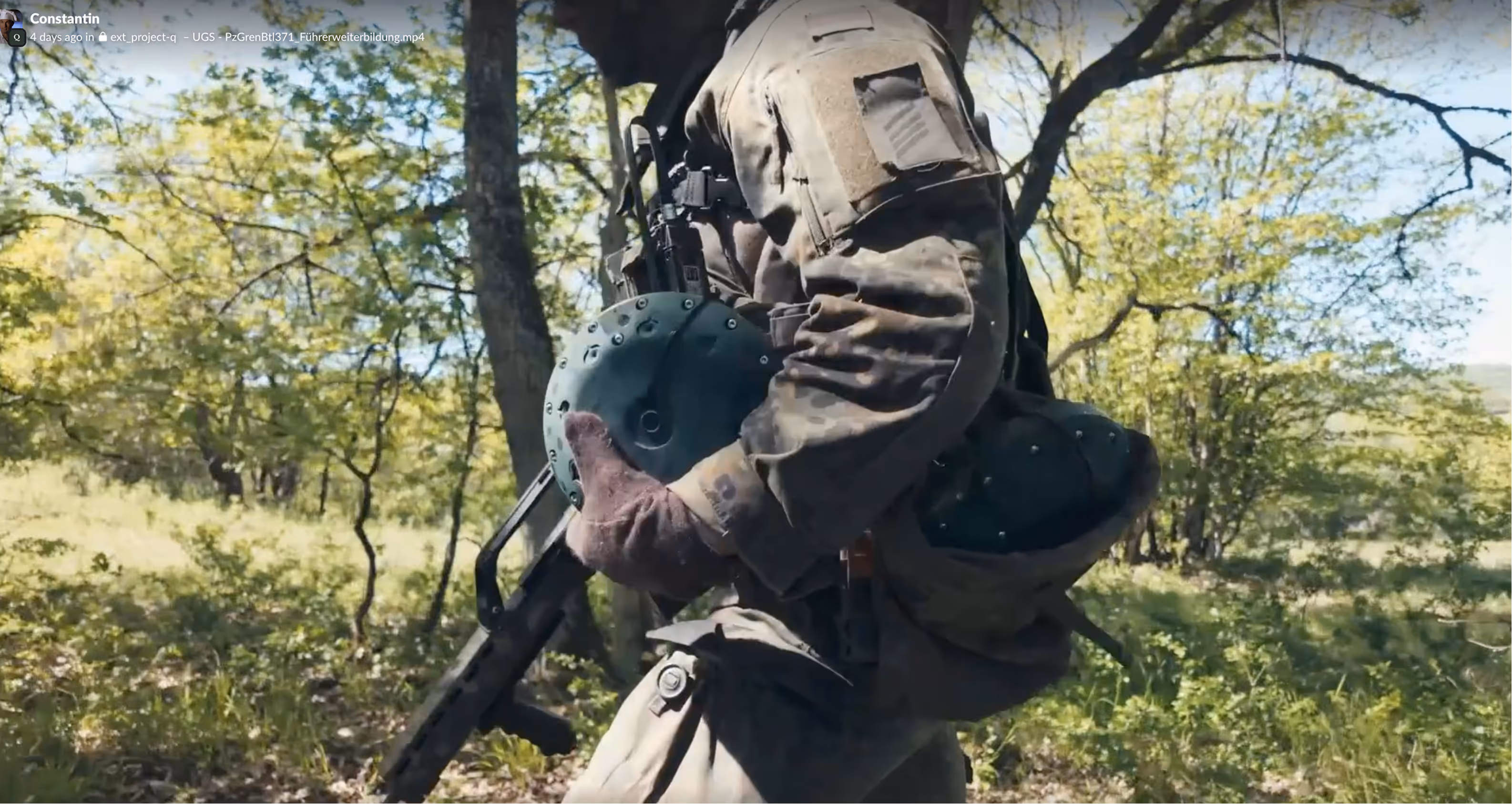
by hand, UAV, or UGV; self-meshing
- EXTENDS
through Hydris to any C2, sensor, or system
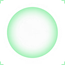
Deploy passive sensors along supply routes under FPV threat, at contested borders, around perimeters, or across named areas of interest.
The sensors detect ground and low-flying aerial targets through their seismic and acoustic signatures, transmitting only upon detection. They fill the gaps line of sight cannot reach and reveal threats that remain invisible in the electromagnetic spectrum. Modular and open by design, the network scales from a handful of sensors to wide-area deployments and integrates third-party sensors seamlessly through Hydris.
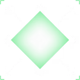
Ø 210 x 58 mm
low-profile dome, low signature< 2 kg
man-portable, drop-and-go30+ days
endurance on a single chargeIP67
sealed, all-environment
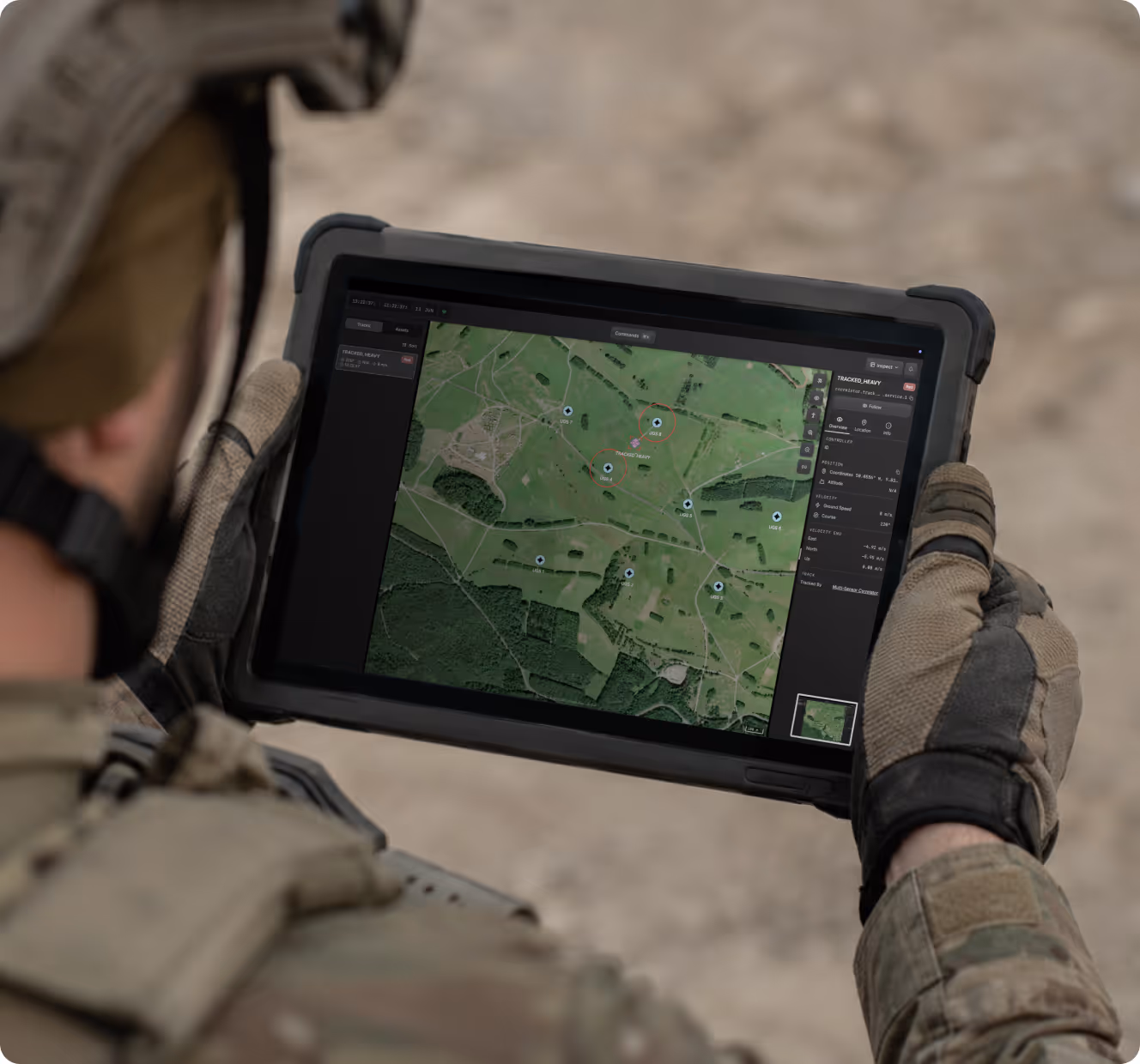
 DUAL-DOMAIN SENSINGSeismic and acoustic in one node — ground and low air.
- EDGE PROCESSINGClassifies on-node; transmits only on detection.
- 30+ DAY ENDURANCEWeeks unattended on a single charge.
- IP67 / ALL-ENVIRONMENTSealed against water, dust, and temperature.
- RAPID EMPLACEMENTSited in seconds, by hand, UAV, or UGV.
- RESILIENT COMMSCommunication options available (RF/LTE/SATCOM)
Field-ready in minutes.
- 1Set up and connect
- 2Emplace
- 3Detect & Act
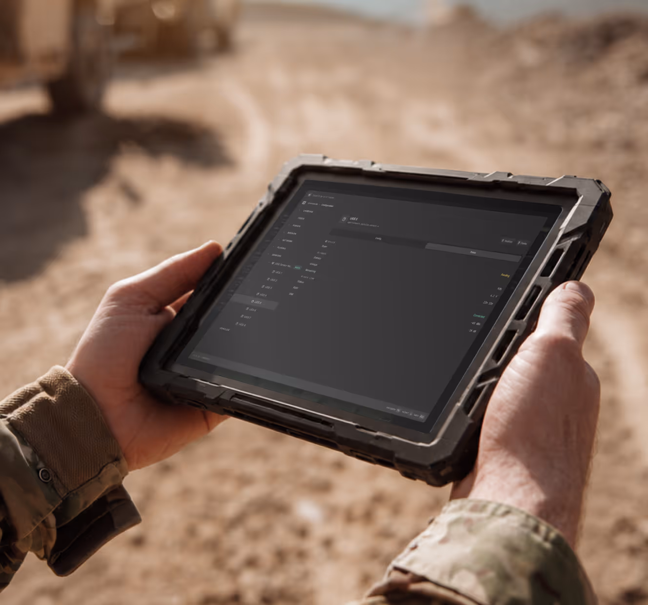
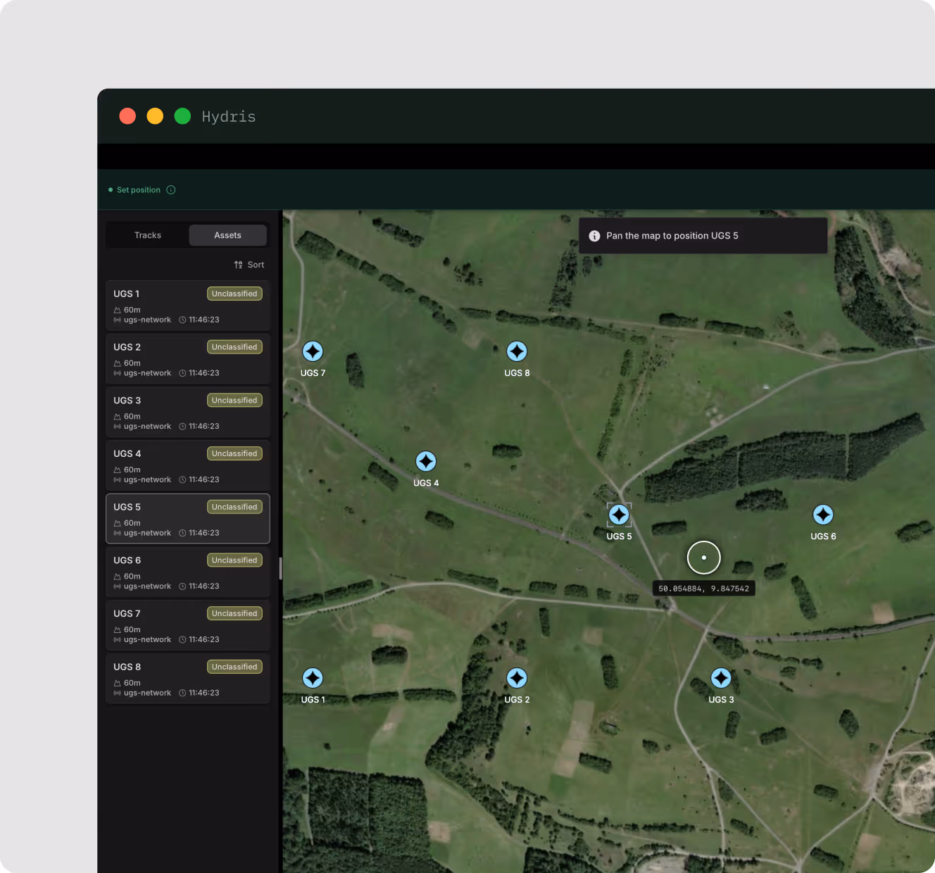
From a tablet, Hydris automatically discovers and provisions every sensor, then feeds your existing C2 via standard interfaces. Plan coverage directly on the map — no forward configuration required.
Place sensors by hand or deploy them from stand-off range via UGV or UAV – minimizing operator exposure.
The network operates unattended for weeks. When a target is detected, the nearest nodes classify it at the edge — vehicle, dismount, or drone — and provides a bearing. Alerts arrive early enough to cue secondary systems,, reroute forces, or initiate a response.
From one node to a sovereign sensor network
The Mission Kit runs on Hydris, Project Q's open-core software. Detections are fused and classified at the edge, on your network, with no cloud in the loop. As requirements evolve and missions change, new sensors, effectors, and mission systems can be integrated through the Hydris plugin SDK — scaling from a single node to a sovereign sensor network.
The kit is your entry point onto Hydris — the same open layer that runs everything you field next.
Add nodes and the network extends itself, from a single supply route to wide-area coverage.
Write a connector once and Hydris speaks to a new capability — a sensor, effector, or third-party app. It grows in software, not procurement.
Hydris feeds the C2 you already run and folds in any vendor's system over open interfaces and NATO standards.